
Urubamba topographic map
Interactive map
Click on the map to display elevation.
About this map
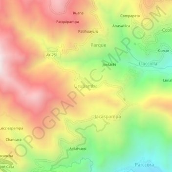
Name: Urubamba topographic map, elevation, terrain.
Location: Urubamba, Province of Huamanga, Ayacucho, Peru (-13.38964 -73.92867 -13.34964 -73.88867)
Average elevation: 10,932 ft
Minimum elevation: 8,773 ft
Maximum elevation: 12,953 ft