
Grashof topographic map
Interactive map
Click on the map to display elevation.
About this map
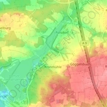
Name: Grashof topographic map, elevation, terrain.
Location: Grashof, Roth, Moyenne-Franconie, Bavière, 90584, Allemagne (49.20862 11.18343 49.24862 11.22343)
Average elevation: 1,309 ft
Minimum elevation: 1,161 ft
Maximum elevation: 1,444 ft