
Dakpathar topographic map
Interactive map
Click on the map to display elevation.
About this map
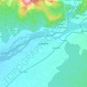
Name: Dakpathar topographic map, elevation, terrain.
Location: Dakpathar, Dehra Dūn, Dehradun, Uttarakhand, India (30.45488 77.75293 30.53488 77.83293)
Average elevation: 1,726 ft
Minimum elevation: 1,401 ft
Maximum elevation: 3,845 ft