
Jogjogan topographic map
Interactive map
Click on the map to display elevation.
About this map
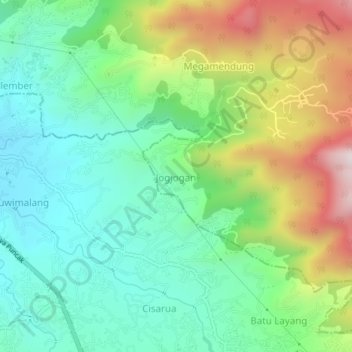
Name: Jogjogan topographic map, elevation, terrain.
Location: Jogjogan, Java occidental, 16750, Indonésie (-6.67604 106.91978 -6.63604 106.95978)
Average elevation: 3,094 ft
Minimum elevation: 2,211 ft
Maximum elevation: 4,875 ft