
Kärdla linn topographic map
Interactive map
Click on the map to display elevation.
About this map
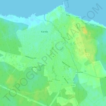
Name: Kärdla linn topographic map, elevation, terrain.
Location: Kärdla linn, Hiiumaa vald, Hiiu maakond, Estland (58.97962 22.71926 59.01038 22.76433)
Average elevation: 26 ft
Minimum elevation: -3 ft
Maximum elevation: 62 ft
Other topographic maps
Click on a map to view its topography, its elevation and its terrain.
Moka küla
Moka küla, Hiiumaa vald, Hiiu maakond, 92128, Estland
Average elevation: 33 ft