
祁曼塔格乡 topographic map
Interactive map
Click on the map to display elevation.
About this map
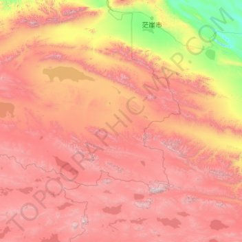
Name: 祁曼塔格乡 topographic map, elevation, terrain.
Location: 祁曼塔格乡, Qakilik, 巴音郭楞蒙古自治州, Xinjiang, China (36.01741 87.36756 37.81256 91.31284)
Average elevation: 14,167 ft
Minimum elevation: 8,816 ft
Maximum elevation: 22,165 ft