
Retiro topographic map
Interactive map
Click on the map to display elevation.
About this map
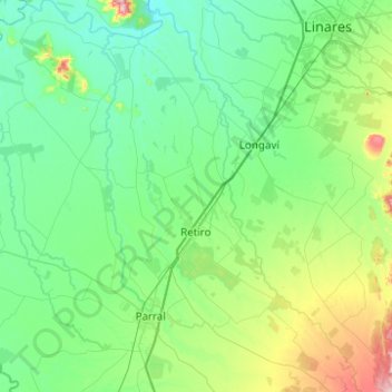
Name: Retiro topographic map, elevation, terrain.
Location: Retiro, Provincia de Linares, Región del Maule, Chile (-36.21799 -72.03941 -35.81800 -71.56481)
Average elevation: 545 ft
Minimum elevation: 312 ft
Maximum elevation: 1,558 ft