
Cazorla topographic map
Interactive map
Click on the map to display elevation.
About this map
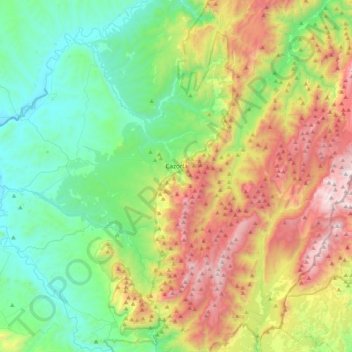
Name: Cazorla topographic map, elevation, terrain.
Location: Cazorla, Jaén, Andalucía, España (37.79111 -3.19173 38.01371 -2.77362)
Average elevation: 3,048 ft
Minimum elevation: 1,181 ft
Maximum elevation: 6,749 ft