
Beusdal topographic map
Interactive map
Click on the map to display elevation.
About this map
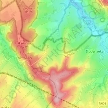
Name: Beusdal topographic map, elevation, terrain.
Location: Beusdal, Blieberg, Luik, Wallonië, 4852, België (50.72997 5.88880 50.76997 5.92880)
Average elevation: 623 ft
Minimum elevation: 377 ft
Maximum elevation: 906 ft