
Felda Aring 1 topographic map
Interactive map
Click on the map to display elevation.
About this map
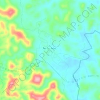
Name: Felda Aring 1 topographic map, elevation, terrain.
Location: Felda Aring 1, Gua Musang, Kelantan, Malaysia (4.93589 102.27415 4.97589 102.31415)
Average elevation: 377 ft
Minimum elevation: 226 ft
Maximum elevation: 755 ft