
Padum topographic map
Interactive map
Click on the map to display elevation.
About this map
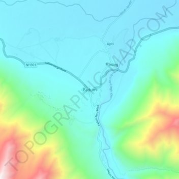
Name: Padum topographic map, elevation, terrain.
Location: Padum, Zanskar, Kargil District, Ladakh, 194302, India (33.44914 76.85818 33.48914 76.89818)
Average elevation: 11,916 ft
Minimum elevation: 11,506 ft
Maximum elevation: 13,773 ft
Padum is at the centre of the tri armed Zanskar valley. It has an average elevation of 3,657 metres (11,998 feet). There are several villages to the north-east of Padum leading to Karsha monastery.