
Mliha topographic map
Interactive map
Click on the map to display elevation.
About this map
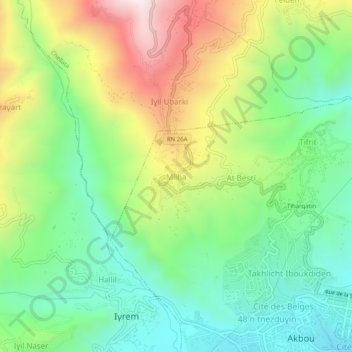
Name: Mliha topographic map, elevation, terrain.
Location: Mliha, Akbou, Daïra Akbou, Béjaïa, 06001, Algérie (36.45816 4.49127 36.49816 4.53127)
Average elevation: 1,732 ft
Minimum elevation: 735 ft
Maximum elevation: 3,428 ft