
Westmeerbeek topographic map
Interactive map
Click on the map to display elevation.
About this map
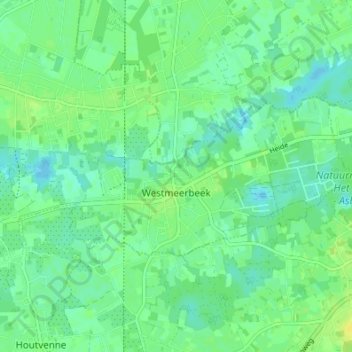
Name: Westmeerbeek topographic map, elevation, terrain.
Location: Westmeerbeek, Hulshout, Turnhout, Antwerpen, Vlaanderen, België (51.05265 4.80085 51.07207 4.86883)
Average elevation: 36 ft
Minimum elevation: 13 ft
Maximum elevation: 69 ft
Other topographic maps
Click on a map to view its topography, its elevation and its terrain.