
Aymavilles topographic map
Interactive map
Click on the map to display elevation.
About this map
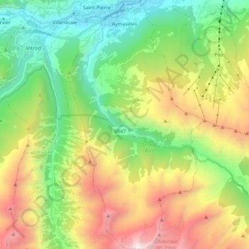
Name: Aymavilles topographic map, elevation, terrain.
Location: Aymavilles, Aosta Valley, Italy (45.59604 7.20987 45.71275 7.30065)
Average elevation: 6,004 ft
Minimum elevation: 1,985 ft
Maximum elevation: 12,913 ft