
นครพนม topographic map
Interactive map
Click on the map to display elevation.
About this map
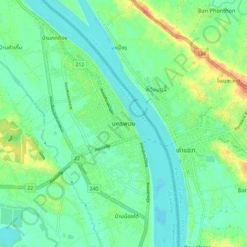
Name: นครพนม topographic map, elevation, terrain.
Location: นครพนม, หนองญาติ, Nakhon Phanom, 48000, Thailand (17.36323 104.74531 17.44323 104.82531)
Average elevation: 482 ft
Minimum elevation: 436 ft
Maximum elevation: 591 ft
Other topographic maps
Click on a map to view its topography, its elevation and its terrain.