Geolocate

Tebet Timur topographic map

Click on the map to display elevation.

About this map
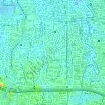
Name: Tebet Timur topographic map, elevation, terrain.

Location: Tebet Timur, Tebet, South Jakarta, Special Capital Region of Jakarta, 12820, Indonesia (-6.24303 106.85183 -6.22417 106.85871)

Average elevation: 66 ft

Minimum elevation: 39 ft

Maximum elevation: 138 ft

Other topographic maps

Click on a map to view its topography, its elevation and its terrain.
Tebet EcoPark

Indonesia > South Jakarta

Average elevation: 69 ft

Gear up for your next adventure:

☀️Outdoor Sunscreen - High protection sunscreen for outdoor activities
🗺️Topographic Maps - Detailed topo maps for hiking, exploring and outdoor navigation
🛶Inflatable Kayak - Portable kayak for rivers, lakes, and expeditions
🏔️Mountain Trail Maps - High‑detail maps for popular peaks
🌧️Backpack Rain Cover - Keep gear dry in wet weather

As an Amazon Associate, this site earns from qualifying purchases at no extra cost to you.