
Ilo topographic map
Interactive map
Click on the map to display elevation.
About this map
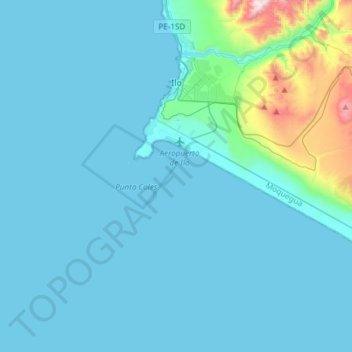
Name: Ilo topographic map, elevation, terrain.
Location: Ilo, Province of Ilo, Moquegua, 18601, Peru (-17.82148 -71.38145 -17.62107 -71.08199)
Average elevation: 354 ft
Minimum elevation: 0 ft
Maximum elevation: 3,622 ft
Other topographic maps
Click on a map to view its topography, its elevation and its terrain.