
Columbe topographic map
Interactive map
Click on the map to display elevation.
About this map
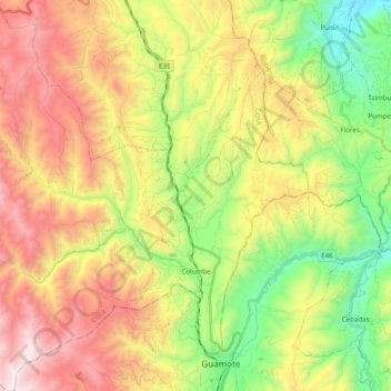
Name: Columbe topographic map, elevation, terrain.
Location: Columbe, Colta, Chimborazo, Ecuador (-1.94756 -78.85444 -1.75171 -78.66704)
Average elevation: 11,217 ft
Minimum elevation: 8,911 ft
Maximum elevation: 14,019 ft
Other topographic maps
Click on a map to view its topography, its elevation and its terrain.
Colta
Ecuador > Chimborazo > Colta > Cajabamba
Colta, Cajabamba, Colta, Chimborazo, 060410, Ecuador
Average elevation: 11,152 ft