
Mortero topographic map
Interactive map
Click on the map to display elevation.
About this map
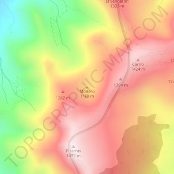
Name: Mortero topographic map, elevation, terrain.
Location: Mortero, Soba, Asón-Agüera, Cantabria, Cantabrie, Espagne (43.20728 -3.66500 43.20738 -3.66490)
Average elevation: 3,753 ft
Minimum elevation: 2,221 ft
Maximum elevation: 4,833 ft
Other topographic maps
Click on a map to view its topography, its elevation and its terrain.
Villaverde
Espagne > Cantabria > Asón-Agüera > Soba > Villaverde
Villaverde, Soba, Asón-Agüera, Cantabria, Cantabrie, 39806, Espagne
Average elevation: 1,923 ft
Soba
Espagne > Cantabria > Asón-Agüera > Soba
Soba, Asón-Agüera, Cantabria, Cantabrie, Espagne
Average elevation: 2,602 ft