
Machota topographic map
Interactive map
Click on the map to display elevation.
About this map
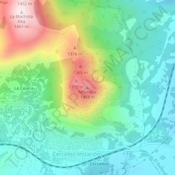
Name: Machota topographic map, elevation, terrain.
Location: Machota, Zarzalejo, Sierra Oeste, Comunidad de Madrid, España (40.54936 -4.16043 40.54946 -4.16033)
Average elevation: 3,612 ft
Minimum elevation: 3,110 ft
Maximum elevation: 4,787 ft