
Amaravati topographic map
Interactive map
Click on the map to display elevation.
About this map
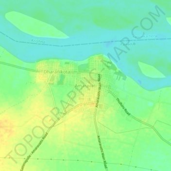
Name: Amaravati topographic map, elevation, terrain.
Location: Amaravati, Amaravathi, Guntur, Andhra Pradesh, 522020, India (16.55442 80.33561 16.59442 80.37561)
Average elevation: 92 ft
Minimum elevation: 56 ft
Maximum elevation: 135 ft
Other topographic maps
Click on a map to view its topography, its elevation and its terrain.
Amaravati
India > Andhra Pradesh > Amaravati
Amaravati, Krishna, Andhra Pradesh, India
Average elevation: 10 ft