
Münster topographic map
Interactive map
Click on the map to display elevation.
About this map
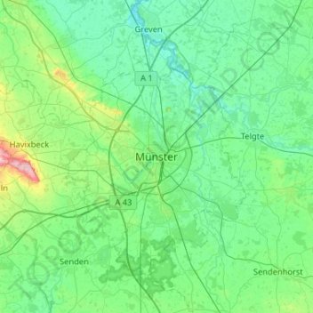
Name: Münster topographic map, elevation, terrain.
Location: Münster, North Rhine-Westphalia, 48143, Germany (51.80251 7.46519 52.12251 7.78519)
Average elevation: 203 ft
Minimum elevation: 121 ft
Maximum elevation: 630 ft