

Juticalpa topographic map
Click on the map to display elevation.
Juticalpa
The climate is significantly warmer than Tegucigalpa or nearby Campamento because of the Valle de Juticalpa's elevation. Several thunderstorms occur during the period of May through September (wet season). October, November and December are cooler and often cloudy with drizzle. From January through April, the region receives very little rain (Dry Season). During this season field fires are often observed, some are intentionally created due to an old unlawful practice for renewing crops, and others are the result of severe heat or arson; these fires create a thick blanket of smoke that settles over the Juticalpa Valley for almost a month. The air improves after the first rain. During the rainy season, the incidence of dengue fever is quite high due to the many mud puddles that become breeding grounds for mosquitoes.
About this map
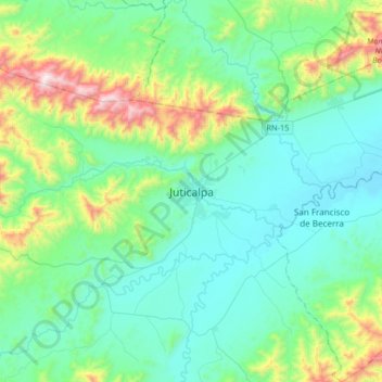
Name: Juticalpa topographic map, elevation, terrain.
Location: Juticalpa, Olancho, 16101, Honduras (14.50720 -86.37958 14.82720 -86.05958)
Average elevation: 1,860 ft
Minimum elevation: 1,089 ft
Maximum elevation: 4,915 ft