
Selden topographic map
Interactive map
Click on the map to display elevation.
About this map
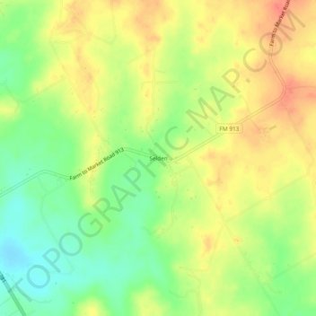
Name: Selden topographic map, elevation, terrain.
Location: Selden, Erath County, Texas, United States of America (32.12403 -98.12670 32.16403 -98.08670)
Average elevation: 1,302 ft
Minimum elevation: 1,214 ft
Maximum elevation: 1,375 ft