Le Pied du Col topographic map
Interactive map
Click on the map to display elevation.
About this map
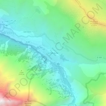
Name: Le Pied du Col topographic map, elevation, terrain.
Average elevation: 6,893 ft
Minimum elevation: 5,223 ft
Maximum elevation: 11,263 ft

Click on the map to display elevation.
Name: Le Pied du Col topographic map, elevation, terrain.
Average elevation: 6,893 ft
Minimum elevation: 5,223 ft
Maximum elevation: 11,263 ft