
Col. Agrícola de Ocotepec (Colonia San José) topographic map
Interactive map
Click on the map to display elevation.
About this map
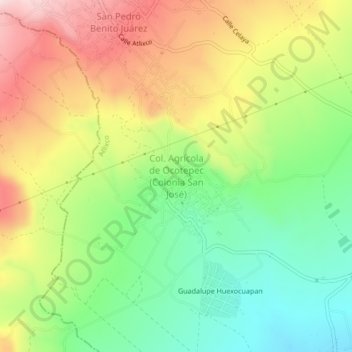
Name: Col. Agrícola de Ocotepec (Colonia San José) topographic map, elevation, terrain.
Average elevation: 7,156 ft
Minimum elevation: 6,611 ft
Maximum elevation: 7,838 ft