
Lauricocha topographic map
Interactive map
Click on the map to display elevation.
About this map
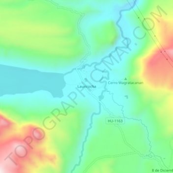
Name: Lauricocha topographic map, elevation, terrain.
Average elevation: 13,130 ft
Minimum elevation: 12,530 ft
Maximum elevation: 14,442 ft
Lauricocha is located at 10°19′20″S 76°40′00″W / 10.32222°S 76.66667°W / -10.32222; -76.66667 on the shores of Lago Lauricocha in the Huánuco Region. The parish consists of half a dozen houses, scattered at an elevation of 3,850 m in a sparsely populated area near the village of Antacolpa, and 25 km northwest of Yanahuanca, the capital of the province of Daniel Alcides Carrión.