
Château de Montecler topographic map
Interactive map
Click on the map to display elevation.
About this map
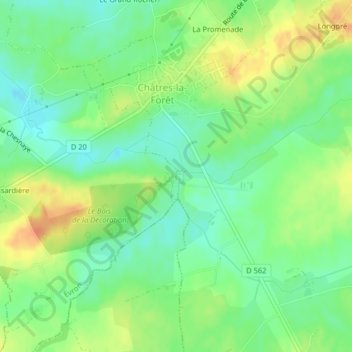
Name: Château de Montecler topographic map, elevation, terrain.
Average elevation: 331 ft
Minimum elevation: 272 ft
Maximum elevation: 404 ft
Other topographic maps
Click on a map to view its topography, its elevation and its terrain.
Les Petïtes Fourches
France > Pays de la Loire > Évron
Les Petïtes Fourches, Saint-Christophe-du-Luat, Évron, Mayenne, Pays de la Loire, France métropolitaine, 53150, France
Average elevation: 361 ft