
Pinofranqueado topographic map
Interactive map
Click on the map to display elevation.
About this map
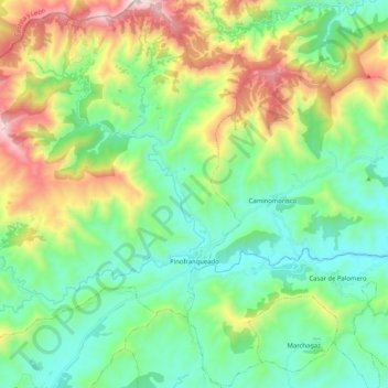
Name: Pinofranqueado topographic map, elevation, terrain.
Average elevation: 2,441 ft
Minimum elevation: 1,283 ft
Maximum elevation: 5,177 ft
Other topographic maps
Click on a map to view its topography, its elevation and its terrain.
Casares de las Hurdes
Espagne > Estrémadure > Las Hurdes
Casares de las Hurdes, Las Hurdes, Cáceres, Estrémadure, Espagne
Average elevation: 2,940 ft