
Oberiberg topographic map
Interactive map
Click on the map to display elevation.
About this map
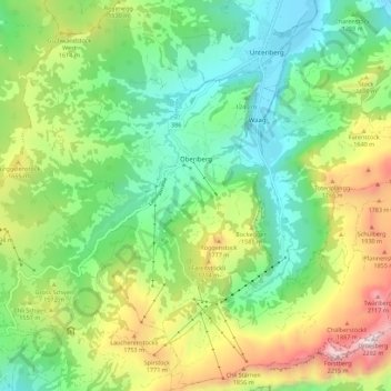
Name: Oberiberg topographic map, elevation, terrain.
Location: Oberiberg, Schwyz, 8843, Switzerland (46.99447 8.73294 47.06960 8.84390)
Average elevation: 4,491 ft
Minimum elevation: 2,956 ft
Maximum elevation: 7,444 ft
Other topographic maps
Click on a map to view its topography, its elevation and its terrain.
Ingenbohl
Switzerland > Schwyz > Schwyz
Ingenbohl, Schwyz, 6440, Switzerland
Average elevation: 2,211 ft
Rickenbach
Switzerland > Schwyz > Schwyz > Schwyz
Rickenbach, Schwyz, 6432, Switzerland
Average elevation: 2,464 ft