
Kibworth Harcourt topographic map
Interactive map
Click on the map to display elevation.
About this map
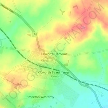
Name: Kibworth Harcourt topographic map, elevation, terrain.
Average elevation: 384 ft
Minimum elevation: 262 ft
Maximum elevation: 535 ft
Other topographic maps
Click on a map to view its topography, its elevation and its terrain.
Gartree
United Kingdom > England > Leicestershire > Harborough District > Foxton
Gartree, Foxton, Harborough District, Leicestershire, England, LE16 7RN, United Kingdom
Average elevation: 351 ft