Geolocate

Warragul topographic map

Click on the map to display elevation.

About this map

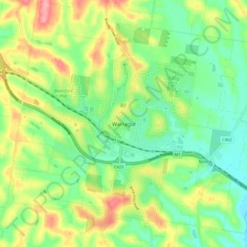
Name: Warragul topographic map, elevation, terrain.

Location: Warragul, Shire of Baw Baw, Victoria, 3820, Australia (-38.19887 145.89363 -38.11887 145.97363)

Average elevation: 436 ft

Minimum elevation: 285 ft

Maximum elevation: 682 ft

Gear up for your next adventure:

🧼Biodegradable Camping Soap - Eco‑friendly soap for outdoor hygiene
🖼️Topo Map Wall Art - Decorative topographic prints of famous peaks and regions
🔥Plasma Lighters - Windproof lighters that work in any weather condition
📷Action Camera - Capture your outdoor adventures in HD
💧Water Filtration Bottles - Safely drink from streams and lakes while exploring

As an Amazon Associate, this site earns from qualifying purchases at no extra cost to you.