
La Pelá topographic map
Interactive map
Click on the map to display elevation.
About this map
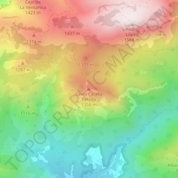
Name: La Pelá topographic map, elevation, terrain.
Location: La Pelá, Totana, Bajo Guadalentín, Region of Murcia, Spain (37.85166 -1.60671 37.85176 -1.60661)
Average elevation: 3,734 ft
Minimum elevation: 2,546 ft
Maximum elevation: 5,108 ft