
Oued El Abtal topographic map
Interactive map
Click on the map to display elevation.
About this map
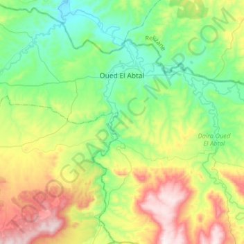
Name: Oued El Abtal topographic map, elevation, terrain.
Location: Oued El Abtal, Daïra Oued El Abtal, Mascara, 29240, Algérie (35.30837 0.50238 35.52068 0.76338)
Average elevation: 1,430 ft
Minimum elevation: 581 ft
Maximum elevation: 3,176 ft