Geolocate

Enschede topographic map

Click on the map to display elevation.

About this map

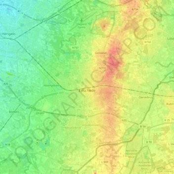
Name: Enschede topographic map, elevation, terrain.

Location: Enschede, Overijssel, Netherlands (52.16121 6.75589 52.28551 6.98110)

Average elevation: 125 ft

Minimum elevation: 49 ft

Maximum elevation: 226 ft

Gear up for your next adventure:

🕶️Glacier Sunglasses - Side shields to protect eyes from high-altitude snow glare
🩳Quick‑Dry Hiking Shorts - Comfortable and quick‑dry shorts for summer hiking
🕶️GPS Smartphone Mount - Secure mount for phone navigation
🦟Ultrasonic Repellers - Create a bug-free zone at your camp or rest stop
🧭GPS Watch Accessories - Bands and chargers for GPS watches

As an Amazon Associate, this site earns from qualifying purchases at no extra cost to you.