
Humedal Santa Rosa topographic map
Interactive map
Click on the map to display elevation.
About this map
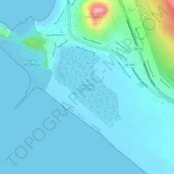
Name: Humedal Santa Rosa topographic map, elevation, terrain.
Average elevation: 66 ft
Minimum elevation: -20 ft
Maximum elevation: 522 ft
Other topographic maps
Click on a map to view its topography, its elevation and its terrain.
Los Laureles
Los Laureles, Chancay, Province of Huaral, Lima, Peru
Average elevation: 177 ft