
Maulbronn topographic map
Interactive map
Click on the map to display elevation.
About this map
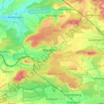
Name: Maulbronn topographic map, elevation, terrain.
Average elevation: 896 ft
Minimum elevation: 617 ft
Maximum elevation: 1,322 ft
Other topographic maps
Click on a map to view its topography, its elevation and its terrain.
Ölbronn
Germany > Baden-Württemberg > Enzkreis > Ölbronn-Dürrn
Ölbronn, Ölbronn-Dürrn, GVV Neulingen, Enzkreis, Baden-Württemberg, 75248, Germany
Average elevation: 909 ft