
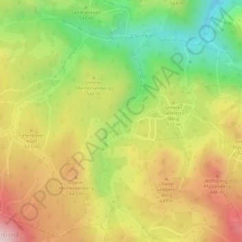
Ilsefälle topographic map
Interactive map
Click on the map to display elevation.
About this map
Name: Ilsefälle topographic map, elevation, terrain.
Average elevation: 1,860 ft
Minimum elevation: 1,165 ft
Maximum elevation: 2,569 ft
Other topographic maps
Click on a map to view its topography, its elevation and its terrain.
Ilsenburg (Harz)
Deutschland > Sachsen-Anhalt > Ilsenburg > Ilsenburg (Harz)
Ilsenburg (Harz), Ilsenburg, Landkreis Harz, Sachsen-Anhalt, 38871, Deutschland
Average elevation: 1,106 ft