
Nkolngok topographic map
Interactive map
Click on the map to display elevation.
About this map
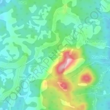
Name: Nkolngok topographic map, elevation, terrain.
Location: Nkolngok, Sa'a, Lekié, Centre, Cameroun (4.21693 11.45599 4.25693 11.49599)
Average elevation: 2,011 ft
Minimum elevation: 1,791 ft
Maximum elevation: 2,598 ft