
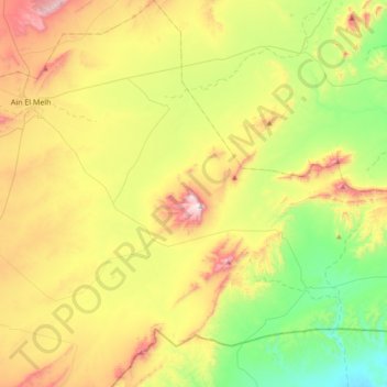
Sidi M'hamed topographic map
Interactive map
Click on the map to display elevation.
About this map
Name: Sidi M'hamed topographic map, elevation, terrain.
Location: Sidi M'hamed, Daïra Aïn El Melh, M'Sila, 28066, Algérie (34.61988 4.16868 34.92783 4.39763)
Average elevation: 2,828 ft
Minimum elevation: 1,814 ft
Maximum elevation: 4,380 ft