
El Khadhra topographic map
Interactive map
Click on the map to display elevation.
About this map
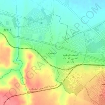
Name: El Khadhra topographic map, elevation, terrain.
Location: El Khadhra, Kasserine Nord, Kasserine, Tunisie (35.15796 8.79362 35.17802 8.82242)
Average elevation: 2,224 ft
Minimum elevation: 2,119 ft
Maximum elevation: 2,369 ft
Other topographic maps
Click on a map to view its topography, its elevation and its terrain.