
Long Island topographic map
Interactive map
Click on the map to display elevation.
About this map
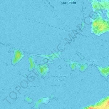
Name: Long Island topographic map, elevation, terrain.
Location: Long Island, Bermuda (32.28538 -64.82523 32.28797 -64.81528)
Average elevation: 3 ft
Minimum elevation: -3 ft
Maximum elevation: 105 ft
Other topographic maps
Click on a map to view its topography, its elevation and its terrain.
Saint George's Island
Bermuda > Saint George's > Town of St. George
Saint George's Island, Town of St. George, Saint George's, Bermuda
Average elevation: 10 ft
Hamilton
Bermuda > City of Hamilton > Hamilton
Hamilton, City of Hamilton, HM 10, Bermuda
Average elevation: 3 ft