
Monte Ortigara topographic map
Interactive map
Click on the map to display elevation.
About this map
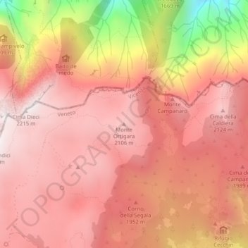
Name: Monte Ortigara topographic map, elevation, terrain.
Location: Monte Ortigara, Asiago, VI, Veneto, Italia (46.00738 11.50722 46.00748 11.50732)
Average elevation: 6,175 ft
Minimum elevation: 3,730 ft
Maximum elevation: 7,195 ft
Other topographic maps
Click on a map to view its topography, its elevation and its terrain.