
Champdepraz topographic map
Interactive map
Click on the map to display elevation.
About this map
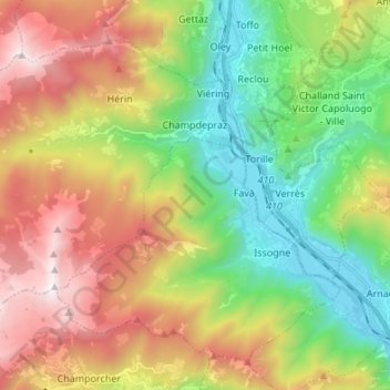
Name: Champdepraz topographic map, elevation, terrain.
Location: Champdepraz, Aosta Valley, 11023, Italy (45.63067 7.53938 45.70570 7.67435)
Average elevation: 4,045 ft
Minimum elevation: 1,135 ft
Maximum elevation: 8,225 ft