
Municipio Shinahota topographic map
Interactive map
Click on the map to display elevation.
About this map
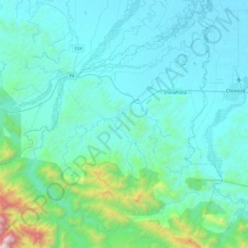
Name: Municipio Shinahota topographic map, elevation, terrain.
Location: Municipio Shinahota, Tiraque, Cochabamba, Bolivia (-17.22936 -65.53929 -16.85880 -65.17216)
Average elevation: 1,621 ft
Minimum elevation: 666 ft
Maximum elevation: 8,963 ft
Other topographic maps
Click on a map to view its topography, its elevation and its terrain.
Angel de la Guarda
Bolivia > Cochabamba > Tiraque > Municipio Shinahota > Angel de la Guarda
Angel de la Guarda, Municipio Shinahota, Tiraque, Cochabamba, Bolivia
Average elevation: 1,283 ft