
Silver Lake topographic map
Interactive map
Click on the map to display elevation.
About this map
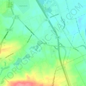
Name: Silver Lake topographic map, elevation, terrain.
Location: Silver Lake, Lexington County, South Carolina, USA (33.86210 -81.06565 33.90210 -81.02565)
Average elevation: 187 ft
Minimum elevation: 98 ft
Maximum elevation: 387 ft