
Bahía Negra topographic map
Interactive map
Click on the map to display elevation.
About this map
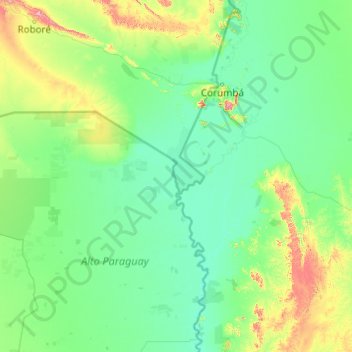
Name: Bahía Negra topographic map, elevation, terrain.
Location: Bahía Negra, Alto Paraguay, Región Occidental, Paraguay (-20.63289 -61.92254 -19.28765 -57.99626)
Average elevation: 518 ft
Minimum elevation: 236 ft
Maximum elevation: 4,193 ft
Other topographic maps
Click on a map to view its topography, its elevation and its terrain.
Puerto Esperanza
Paraguay > Alto Paraguay > Bahía Negra
Puerto Esperanza, Bahía Negra, Alto Paraguay, Región Occidental, Paraguay
Average elevation: 262 ft
Reserva Natural Cabrera - Timane
Paraguay > Alto Paraguay > Bahía Negra
Reserva Natural Cabrera - Timane, Lagerenza'i, Bahía Negra, Alto Paraguay, Región Occidental, Paraguay
Average elevation: 1,030 ft