
16 de Septiembre topographic map
Interactive map
Click on the map to display elevation.
About this map
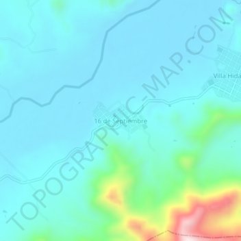
Name: 16 de Septiembre topographic map, elevation, terrain.
Location: 16 de Septiembre, Villaflores, Chiapas, México (16.27613 -93.19349 16.31613 -93.15349)
Average elevation: 1,903 ft
Minimum elevation: 1,660 ft
Maximum elevation: 3,278 ft
Other topographic maps
Click on a map to view its topography, its elevation and its terrain.
16 de Septiembre
México > Chiapas > 16 de Septiembre
16 de Septiembre, San Fernando, Chiapas, México
Average elevation: 2,982 ft