
Hulubelu topographic map
Interactive map
Click on the map to display elevation.
About this map
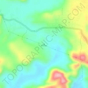
Name: Hulubelu topographic map, elevation, terrain.
Location: Hulubelu, Lampung, Indonésie (-5.35005 104.59995 -5.34995 104.60005)
Average elevation: 2,359 ft
Minimum elevation: 2,162 ft
Maximum elevation: 2,713 ft
Other topographic maps
Click on a map to view its topography, its elevation and its terrain.
Détroit de la Sonde
Détroit de la Sonde, Lampung, Indonésie
Average elevation: 144 ft
Sekincau Belirang
Sekincau Belirang, Lampung, Indonésie
Average elevation: 4,150 ft