
Khenguet Sidi Nadji topographic map
Interactive map
Click on the map to display elevation.
About this map
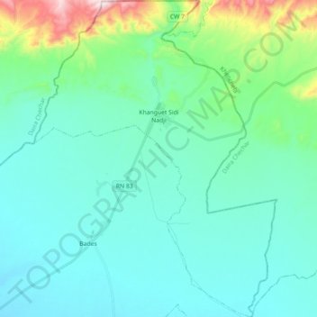
Name: Khenguet Sidi Nadji topographic map, elevation, terrain.
Location: Khenguet Sidi Nadji, Daïra Zeribet El Oued, Biskra, Algérie (34.71227 6.63568 34.85881 6.77252)
Average elevation: 617 ft
Minimum elevation: 243 ft
Maximum elevation: 2,457 ft
Other topographic maps
Click on a map to view its topography, its elevation and its terrain.
M'Ziraa
Algérie > Biskra > Daïra Zeribet El Oued
M'Ziraa, Daïra Zeribet El Oued, Biskra, Algérie
Average elevation: 1,801 ft